Detail View: Selections from the David Rumsey Map Collection I: North America...S.E. Sheet.
|
Filename:
|
00100130.jpg
|
|
Identifier:
|
00100130.jpg
|
|
Title:
|
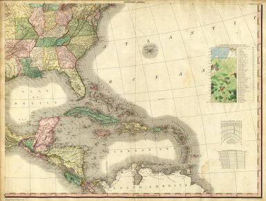
North America...S.E. Sheet.
|
|
Creator:
|
Tanner, Henry S.
|
|
Subject:
|
Mountains and Rivers
|
|
Description:
|
The first edition with the earliest states of all the maps. Many believe this to be the finest atlas published in the United States in the 19th century. The text essay (included here) is a wonderful compilation of information on the contemporary maps that Tanner used as sources. Tanner updated the maps frequently over the next two decades, and issued several editions or compilations of the atlas with the title pages dated 1823 or 1825, but with some of the maps dated as late as 1833. The collation of our six issues show that no two copies are alike and that the maps were being constantly updated; however the choice of maps for each edition reveals a somewhat haphazard approach with some of the earliest states of a particular map appearing the one of the later atlas editions. A completely revised edition was issued in 1839, with the title page and most of the maps dated 1839 (see P1382). Hand painted in outline color with a full color wash. Atlas is bound in half leather marbled paper covered boards with "Tanner's American Atlas" stamped in gilt on a front leather label.
|
|
Publisher:
|
Tanner, Henry S.
|
|
Contributor:
|
David Rumsey Historical Map Collection
|
|
Date:
|
1823
|
|
Language:
|
English
|
|
Rights:
|
Cartography Associates
|