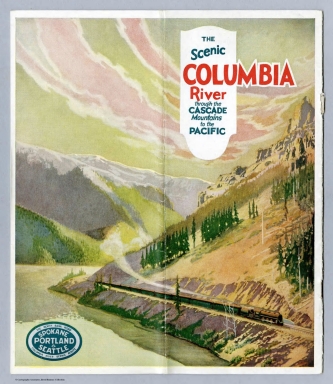
Detail View: Selections from the David Rumsey Map Collection II: Covers: The Scenic Columbia River through the Cascade Mountains to the Pacific.
|
Short Title:
|
Covers: The Scenic Columbia River through the Cascade Mountains to the Pacific.
|
|
Obj Height cm:
|
24
|
|
Object Width cm:
|
11
|
|
Note:
|
Date estimated.
|
|
Reference:
|
Clinton, Craig. "The Pictorial Maps of Fred A. Routledge", Oregon Historical Quarterly Vol. 117, No. 1 (Spring 2016), pp. 36-75. Read here http://www.ohs.org/research-and-library/oregon-historical-quarterly/upload/03_Clinton_Routledge-Maps_117_1_Spring-2016.pdf
|
|
Full Title:
|
(Covers to) The Scenic Columbia River through the Cascade Mountains to the Pacific.
|
|
List No:
|
12453.001
|
|
Series No:
|
1
|
|
Pub Date:
|
1917
|
|
Pub Title:
|
The Scenic Columbia River through the Cascade Mountains to the Pacific.
|
|
Pub Note:
|
Date estimated. Full color. Brochure. Oregon artist and cartographer Fred A. Routledge was especially noted for his pictorial bird's eye views dominated by the natural landscape and making a vision of the world that, prior to generally available air travel, could not be experienced in life. His prizes included a first prize at the 1915 Panama Pacific Exposition in San Francisco. The quality of his pictorial map was to become a significant feature of commercial travel cartography in the 1930s and beyond. (Clinton, Craig.)
|
|
Pub List No:
|
12453
|
|
Pub Maps:
|
1
|
|
Pub Height cm:
|
24
|
|
Pub Width cm:
|
11
|
|
Image No:
|
12453001.jp2
|
|
Publisher:
|
Spokane, Portland and Seattle Railway System
|
|
Publisher Location:
|
Portland
|
|
Type:
|
Covers
|
|
Pub Type:
|
Pamphlet
|
|
Date:
|
1917
|
|
Filename:
|
12453001.jp2
|